Story
The High Line Canal: A Nature Lover’s Escape from the City
The West, wrote Colorado poet laureate Thomas Hornsby Ferril, “is a land where life is written in water.”
Editor’s Note: Portions of this text originally appeared in the author’s introduction to photographer John Abramson’s book Colorado’s High Line Canal: A Portrait, published by the High Line Canal Conservancy in 2023.
Countless acre-feet of that water and volumes of history have flowed through Colorado’s longest and best-known water ditch ever since 1883.
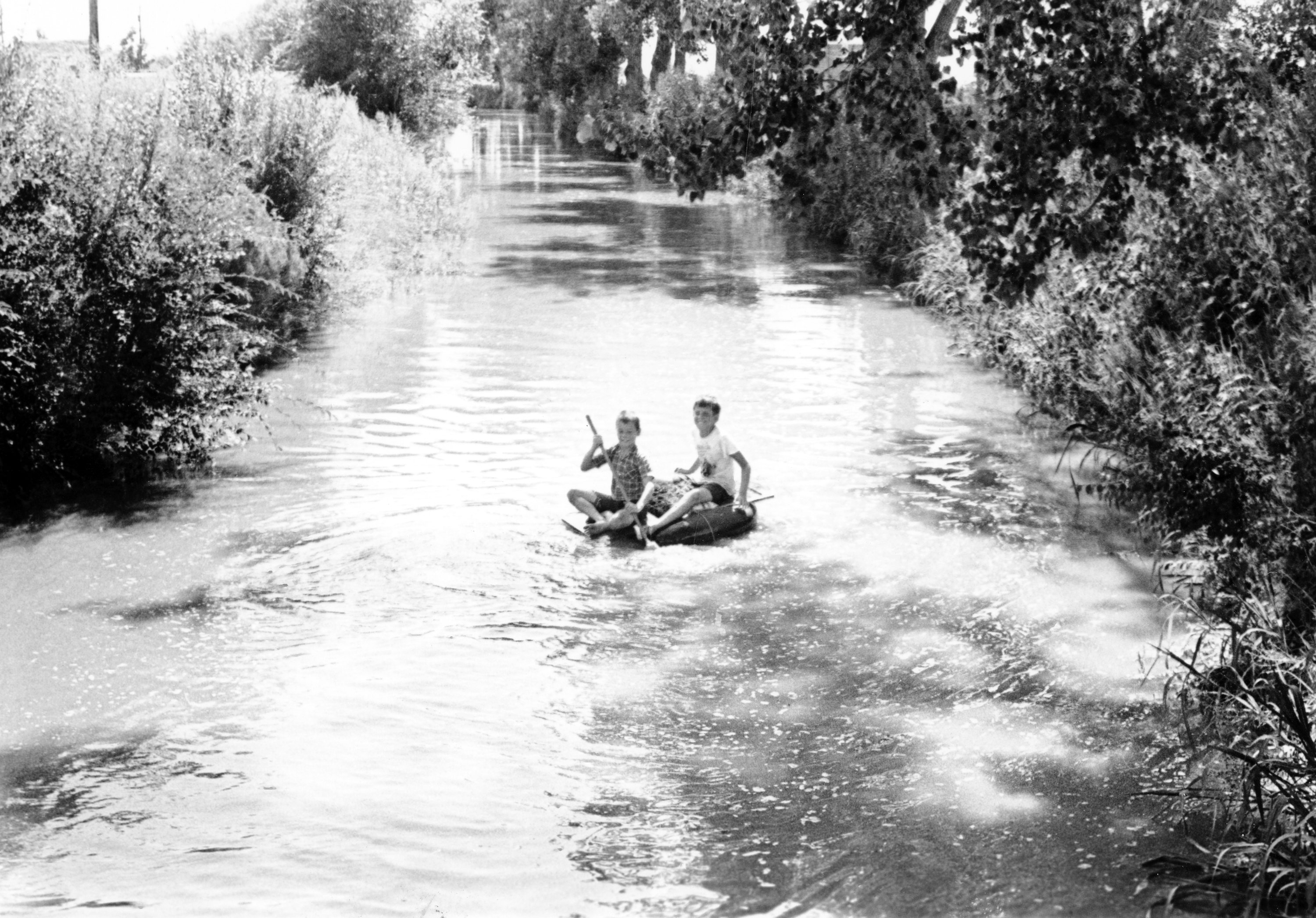
The storied seventy-one-mile-long High Line Canal’s name derives from an engineering principle that uses the contours of the land and elevation to pull water downhill by gravity. And a sort of gravity has also enticed hundreds of thousands of nearby residents who have walked, run, skated, cross-country skied, or ridden horses on what was originally the ditch riders’ trail. Oldtimers may even remember tubing, swimming, and wading there on hot summer days.
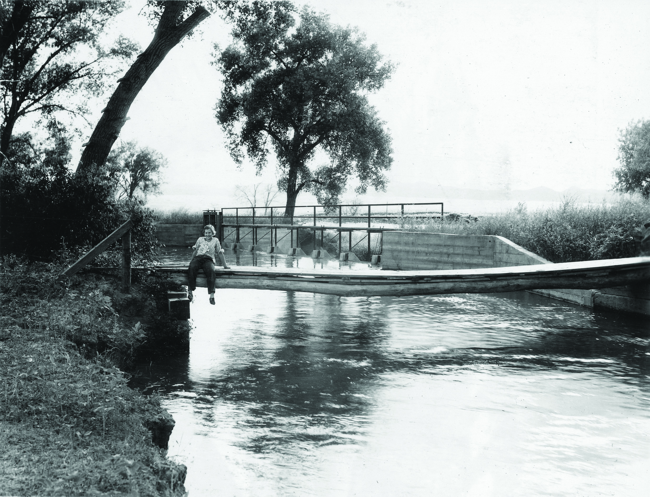
A girl sits over the High Line Canal at Big Dry Creek in the summer of 1935.
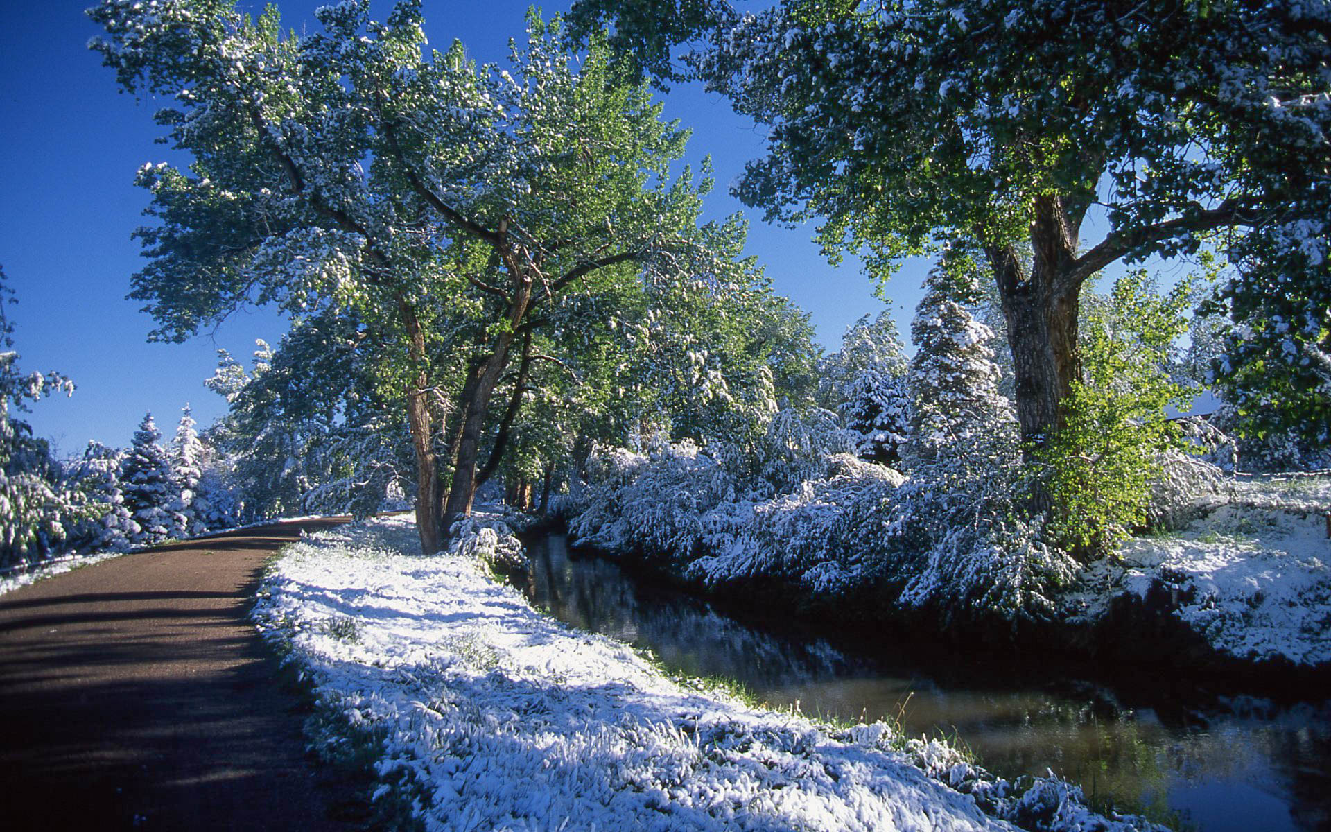
The Canal begins in the South Platte River’s Waterton Canyon, then meanders through today’s Douglas, Arapahoe, Denver, and Adams counties to end at the Green Valley Ranch neighborhood. Before Green Valley’s recent development, one of the Canal’s two original laterals delivered water to the Rocky Mountain Arsenal—today’s Rocky Mountain Arsenal National Wildlife Refuge. The 100- to 150-foot-wide Canal and trail shelters wildlife and recreationists under ancient, towering cottonwoods. In between those stately trees is low, lush shrubbery: chokecherries, plum, scrub oak, willows, and wildflowers.
Denver Water, which owns the Canal, along with the High Line Canal Conservancy and local jurisdictional partners took a tree census of cottonwoods over twelve inches in diameter at breast height or above: 10,224 trees. As mature cottonwoods suck up about 10,000 gallons of water annually, they in turn soak up the water that would otherwise fill the ditch.
Cottonwoods are one of the only native trees on the dry High Plains, growing along natural waterways where they have reached world record–setting girths and heights in Colorado. Healthy trees grow as high as ninety feet, with trunks six feet in diameter. The leaves are heart shaped, and their fluffy white, cotton like seed gives the tree its name. Their sentinel ranks along western waterways have been a most welcome sight—promising shade, water, firewood, and building materials to Indigenous tribes such as the Arapaho and Cheyenne and later to Euro-American settlers. Today, this cottonwood-lined path offers respite from the heat and bustle of twenty-first century urban life.
Colorado’s Big Canal
Joining Denver’s City (aka Smith) Ditch as one of Colorado’s first major canals, the High Line was undertaken by a British firm organized by the Scottish entrepreneur James Duff. Doing business as the Northern Colorado Irrigation Company, British investors based in London financed the Canal. Brits accustomed to their watery isles did not realize that the High Line Canal’s Water Right No. 111, granted in 1879, meant that “the Englishmen’s Folly” would often dry up. Even in years of normal precipitation, the Canal did not have enough water to serve all its customers. Farmers not receiving water they paid for were constantly suing, keeping the Canal in financial and legal trouble.
The High Line Canal was only one of many proposals to water the Great Plains. President Ulysses S. Grant and other visionaries championed a giant canal that would connect the skimpy South Platte with the wide Missouri. Others suggested diverting some of the Columbia River south to the parched Great Plains. More realistic assistance came with the 1909 construction of Antero Reservoir in South Park as a new source of water to feed the High Line Canal. That, according to the project’s prospectus, would mean “bountiful crops, good buildings, sleek cattle, intense farming, tree shaded suburbs,” and even “polite bankers.”

A crowd attends the launching of the High Line Canal.

Beginning in 1879, High Line Canal construction crews used 3,123 feet of flumes to keep the water flowing with a minimal drop of two feet per mile. Construction supervisor Benjamin Harrison Easton served as Governor of Colorado from 1885 to 1887, after finishing the Canal in 1883. The Canal originally included two laterals—the Sand Creek Lateral and the Derby Lateral—with the system totaling 86 miles long; it is now only 71 as its lower end has gone to other uses.

To penetrate Waterton Canyon and keep water on the high line, the builders of the High Line Canal bored this 600-foot tunnel.

This 1885 shot of Waterton Canyon by William Henry Jackson shows the South Platte River, the High Line Canal, and the freshly laid Denver, South Park & Pacific Railway tracks. That narrow gauge railway was built through the canyon on its way to South Park and beyond.
Preserving the High Line for Recreation
In 1924 the City of Denver, through its water commissioners—the entity that would become today’s Denver Water—bought the High Line Canal for $1.05 million. Then, in the 1960s, Denver Water and other interested parties began focusing on recreational uses rather than agriculture. Preservation for recreational use began with the Arapahoe County Open Space and Trails program approved by the voters in 2002. In 2011, Arapahoe County and eleven surrounding governmental jurisdictions created the High Line Canal Working Group of elected officials, key staff, and members of the community to plan for the long-term future of the Canal.
This group in 2014 led to the creation of the nonprofit High Line Canal Conservancy, helmed by founding CEO Harriet Crittenden LaMair. The Conservancy has spearheaded comprehensive planning to ensure a vital future for the Canal as an 860-acre linear park and metro Denver’s largest recreation district. The Canal’s many allies are working with Denver Water to keep it preserved and protected into the future.
The High Line Canal Conservancy’s 2019 framework plan, The Plan for the High Line Canal identifies $130 million in prioritized capital improvements over fifteen years. These improvements include access and infrastructure, landscape enhancements, user amenities, historical resources, stormwater management, and interpretive signage. While the Canal often runs dry, its trail continues to flow with people and their pets. Since 2018 water has not run past Hampden Avenue, leaving the northern half of the Canal mostly dry. This may change with a regional plan, led by the Mile High Flood District, to direct stormwater into the Canal. This could bring occasional flows of water back to sixty-two of the seventy-one Canal miles. More importantly, it would benefit north Aurora and northeast Denver’s more economically disadvantaged neighborhoods that are short on recreational amenities and sit at the dry end of the Canal.
After Denver Water acquired the High Line Canal, it restricted access until 1970, when it partnered with surrounding municipalities to lease them sections of the Canal as a pedestrian, equestrian, and bicycle pathway. That partnership has evolved, with the leadership of the High Line Canal Conservancy, into the Canal Collaborative—a regional management structure with thirteen regional partners, including Arapahoe County Open Spaces, City of Aurora, City of Cherry Hills Village, City and County of Denver, Denver Water, Douglas County, City of Greenwood Village, Highlands Ranch Metro District, High Line Canal Conservancy, City of Littleton, Mile High Flood District, Southeast Metro Stormwater Authority, and South Suburban Parks and Recreation. Many parks, along with residential and commercial developments, have sprung up along this greenway. Nearly all of them are carpeted with the hard, brown cottonwood leaves that rustle and crackle in the slightest breeze.
Denver Water manages the Canal channel and its delivery system, while many of the above-listed public agencies maintain the adjacent High Line Canal trail and the Canal’s emerging function as green stormwater infrastructure. For its historical and architectural significance, the site was designated a National Waterworks Landmark in 1975 (with the correct two-word spelling, not the often-used but incorrect “Highline”). Also listed in the Historic American Engineering Record, the Canal is celebrated as an engineering wonder built by hundreds of men and horses. They also constructed its 600-foot tunnel and more than 3,100 linear feet of flumes, 216 feet of dams, and many headgates. A 120-foot diversion dam at the head of the Canal redirects water for its tunnel intake.
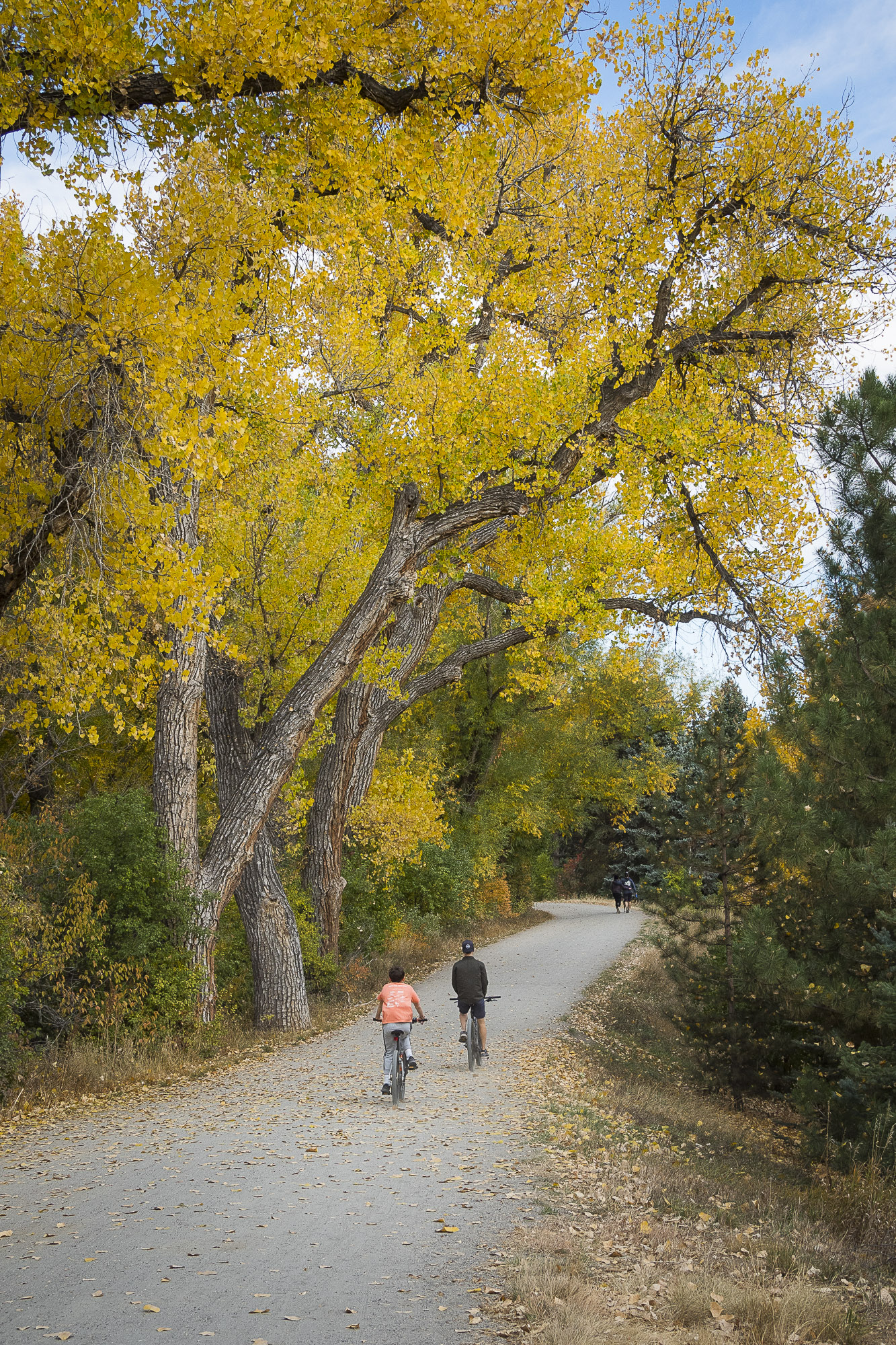
The High Line Canal is metro Denver’s longest regional trail. It is called the “High Line” because it flows by gravity from a high point in Waterton Canyon along a descending line. Created as an agricultural attraction, it has evolved into a recreational magnet.
Today’s High Line Canal traverses the socioeconomic mosaic of metro Denver—from mega mansions to low-income housing. More than a million enjoy it every year. Over 340,000 people live within a mile of the Canal, and twenty-four schools lie within a quarter mile. The Conservancy and its partners continue to improve the Canal path. In 2021, Arapahoe County and the City and County of Denver completed a major improvement by building tunnels for the trail under Colorado Boulevard and Hampden Avenue at a jammed intersection that trail users had to negotiate at street level.
To get the Canal trail over Interstate 70, Smith Road, and main-line rail to connect with the north end of the trail, a major project begun in 2023 is currently scheduled for completion in 2024. This will close the three-mile gap between East Colfax Avenue and north of I-70 with an eight-foot-wide concrete trail with pedestrian bridges. The City of Aurora is the lead partner on this most extensive Conservancy improvement to date.
As the Canal is a treasured amenity and backyard, construction is constant along much of its winding route. All the more reason to connect people with a ribbon of nature in an increasingly denser urban corridor.
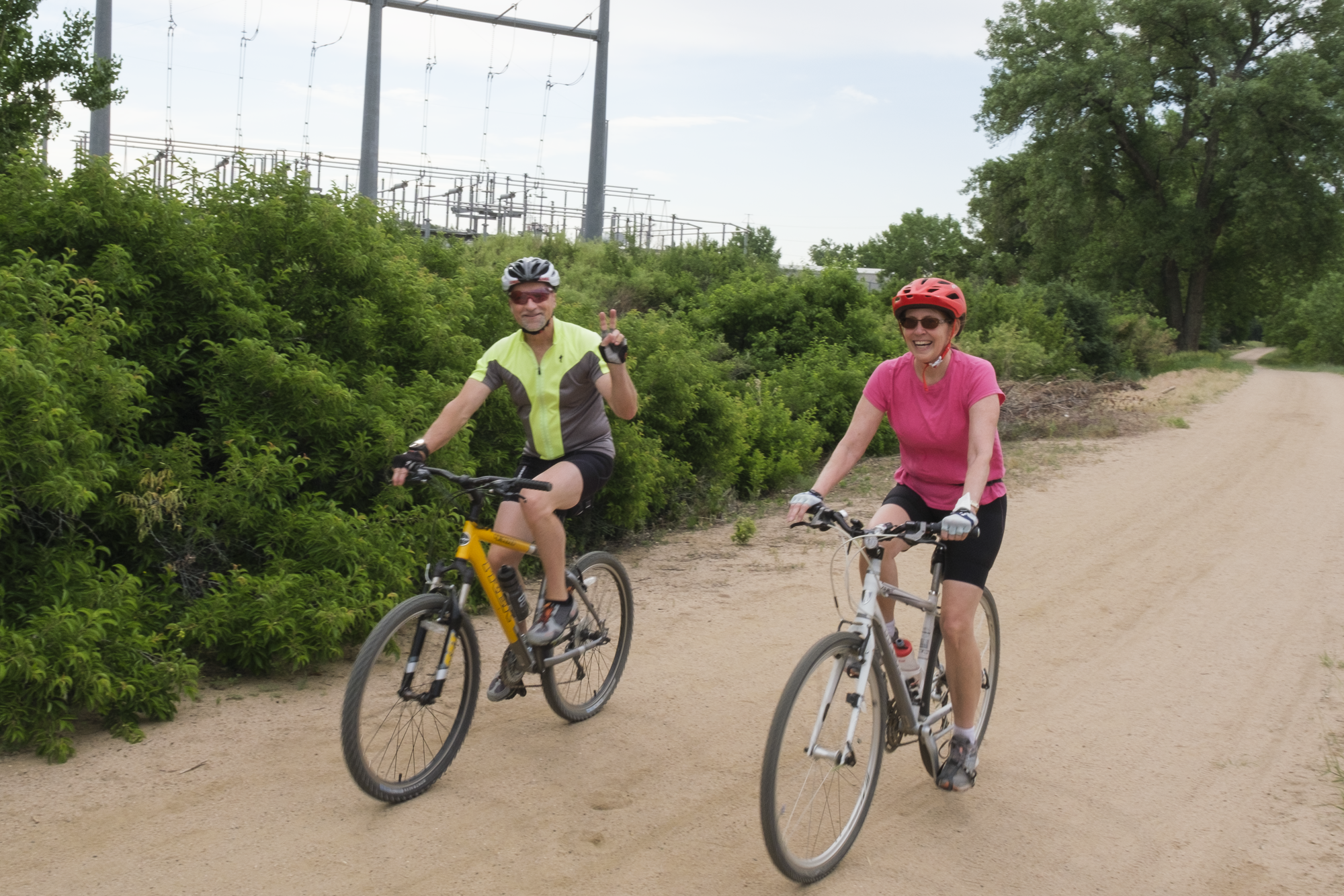
The gentle grade of the 71-mile-long High Line Canal is bicycle friendly.
Today’s Trail Users
For his 2023 book Colorado’s High Line Canal: A Portrait, Denver photographer and author John Abramson photographed more than 150 people along the Canal on behalf of the High Line Canal Conservancy. As Abramson spoke with his portrait subjects and corresponded with them afterwards, he learned that “Getting out on the trail for these people meant a connection with their neighbors and with nature, and regular exercise. A walk on the Canal was healing; it was quiet, calming, a place where they could reflect on and escape from the news or the concerns of home or the office.” Many times he heard that the trail was a source of “solace.”
He met people who had loved the High Line Canal all their lives. “There were stories of growing up when water flowed in the Canal, and of learning to swim in it,” he writes. “The beauty of the Canal inspired photographers and painters who sent me samples of their work.”
Abramson met people like Patti and James Keyworth, residents of Windsor Gardens in Denver’s Lowry neighborhood, who share a deep, personal connection to the “ribbon of nature” that the Canal represents in their lives. They were both raised in Central Denver, and the High Line Canal was always a treasured place for them. The Keyworths chose to live in Windsor Gardens in large part because it backed up to the Canal. For Patti and James, the joys of cycling along the Canal offer a respite from big-city streets. They love that people from all walks of life share the Canal in harmony and even camaraderie. James puts it best when he says that he senses “a connection with nature in all its magnificence, a sense of perspective that is increasingly difficult to experience in our harried daily existence, an awareness of the universal harmony we lose sight of in our daily lives…. And that, in today’s world, is irreplaceable.”

Heesung Kim at the South Quebec Way trailhead.

Kariem Q. Muhammad in Del Mar Park, Aurora.

Sergey and Kate Matyukevich in Expo Park.

Patti and James Keyworth with Karl, in the Windsor neighborhood.
Among his many encounters, Abramson also met Allen Wong, the owner of a violin shop who found a “lifeline” in the Canal trail during the Covid-19 lockdowns: “With the advent of the pandemic,” Wong told him, “I took myself off the treadmill and started a daily ritual of walking along the High Line Canal.” Likewise Heesung Kim, whom Abramson met nearby at the South Quebec Way Trailhead, had walked or biked the Canal trail nearly every day of the pandemic. In Denver’s James A. Bible Park, Abramson met Gracian Mariathasan, whose family immigrated from Sri Lanka some forty years ago after gaining political asylum. Now, his family lives in a home with a view of the Canal. In the same park, Wilson and Susan Kendall told Abramson that they had moved away from the Canal but came back regularly for walks. In Aurora’s Del Mar Park, Abramson met Kariem Q. Muhammad carrying a Muslim prayer rug; Muhammad “often floated down the Canal as a child,” he told Abramson.
“He’s seen a fox in this vicinity and is forever on the lookout to spot it again.” And in Aurora’s Expo Park he photographed Sergey Matyukevich, a software engineer from Belarus whose daughter, Kate, pets “every single dog” she meets along the trail.
“Despite all the differences among the people I photographed,” Abramson writes, “there were common themes. The trail is common ground, a safe zone, even a state of mind. People can be themselves and feel comfortable there.” In short, he says, the High Line Canal is “an essential part of their lives.”
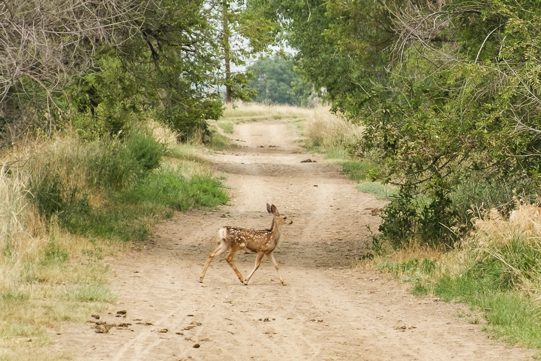
The Canal is a haven for wildlife where deer such as this fawn find forage and, sometimes, water.
The Future
In years to come, trail users will see even more enhancements to the Canal, such as new underpasses, more pedestrian bridges, and more benches, reports Harriet Crittenden LaMair, founding CEO of the High Line Canal Conservancy.
“Our world today demands innovative approaches that can preserve and reuse historic infrastructure for parks and open spaces,” LaMair says. “The Canal, a cherished landmark of our agricultural history, serves as a living example of the changing climate and need for water conservation. The Plan for the High Line Canal is the result of thousands of voices, representing all 71 miles of the Canal, saying they want the Canal preserved and enhanced as a natural refuge. It is through close and intimate contact with a particular patch of ground that we learn to respond to the earth.”
Though made by humans and paved in places, the canal remains a bridge to nature.
Acknowledgments
Thanks to Harriet Crittenden LaMair, Suzanna Fry Jones, Libby Hodgin, Debbie Fitzgerald, Josh Phillips, Regan Petersen, editor Steve Grinstead, and John Abramson.
For Further Reading
John Abramson, Colorado’s High Line Canal: A Portrait. Denver: The High Line Canal Conservancy, 2023.
Louisa Ward Arps, Denver in Slices. Denver: Sage Books, 1959.
Robert C. Baron, Stephen J. Leonard, and Thomas J. Noel, editors, in Thomas Hornsby Ferril and the American West. Golden: Fulcrum Publishing, 1996. The same anthology contains Ferril’s poem “High-Line Ditch” and “Here is a Land...,” which adorns the interior dome of the Colorado State Capitol.
Thomas Hornsby Ferril, Westering. New Haven: Yale University Press, 1934 (reprinted 1986, Ahsahta Press, Boise State University).
Holly Geist, Denver Water Records Manager and Analyst. Interview by Tom Noel, August 29, 2023.
High Line Canal Conservancy, The Plan for the High Line Canal: New Life for the 71-Mile Canal. Centennial, CO: High Line Canal Conservancy, 2019. highlinecanal.org/plan/
High Line Canal Conservancy, Reconnaissance Survey and Prioritized Survey Plan: High Line Canal Corridor. Centennial, CO: High Line Canal Conservancy, 2016.
High Line Reservoir Company Prospectus. Denver: High Line Reservoir Prospectus, 1891.
Michael Creed Hinderliter Collection. Stephen H. Hart Research Center, History Colorado, Denver.
Earl L. Mosley, History of the Denver Water System, 1858–[1919] (2 vols.), 1969.
Robert Michael Pyle, The Thunder Tree: Lessons from an Urban Wildland. Boston: Houghton Mifflin, 1993.
Crawford Scott, Wogging the Highline. Englewood, CO: Lord Publishing, 1986.
James E. Sherow, “Watering the Plains: An Early History of the High Line Canal.” Colorado Heritage 1988, Issue 4. Denver: Colorado Historical Society (History Colorado), 1988.
David Skari, High Line Canal: Meandering Through Time—A Historical Trail Guide. Denver: C&M Press, 2003.

