Story
Imagining a Great City
Denver, 1980-2020
Mayor Federico Peña’s campaign vision to “Imagine a Great City'' catalyzed the development of Denver and its region from the 1980s onward. Against the backdrop of a boom-and-bust economy, major public projects shaped the trajectory of the city along with its residents’ grassroots advocacy.
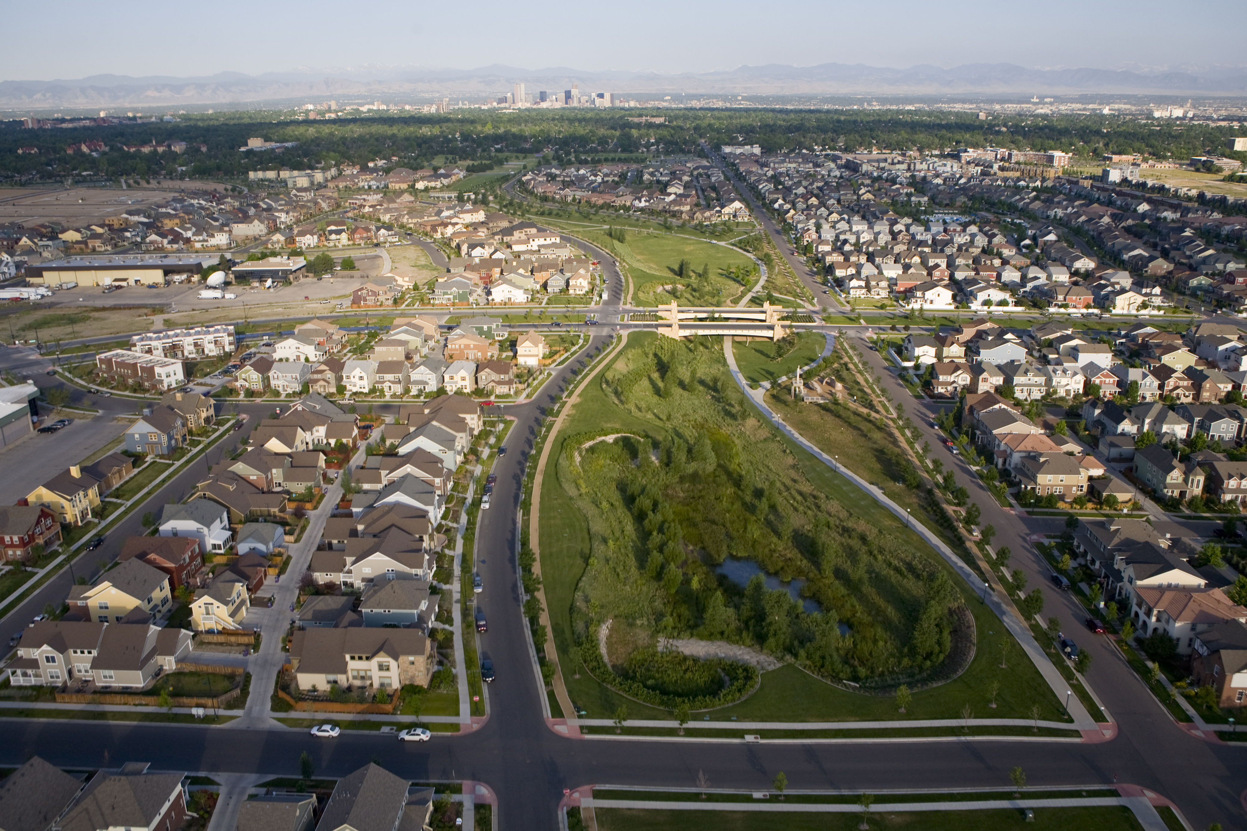
View of Central Park (formerly known as Stapleton), late 1990s. Courtesy Forest City and AECOM.
Building Denver: Visions of the Capital City
Building Denver: Visions of the Capital City explores the architectural and urban development of Denver from its founding in 1860 onward through the lens of the many visions that have shaped the city. The exhibition takes as its point of departure the notion that cities are the products of intentional acts—that they are defined by decisions that begin as visions. Once realized, these city-defining decisions are built upon and against, lived with and through, embraced and rejected, confronted and transformed.
The exhibition is the centerpiec of History Colorado's broader Building Denver initiative. Through exhibitions, programs, podcasts, and more, the initiative merges issues of design and planning with the lived experiences of Denverites, offering a layered history of the city’s built environment and asking each of us to share our own vision for the Denver of tomorrow.
Excerpted here is a section of the author’s chapter in Is This the City We Imagined? Decisions That Define Denver, an anthology inspired by the exhibition that offers perspectives on Denver’s future from some of the city’s key figures and thought leaders, forthcoming this summer from History Colorado.
Now on view at the History Colorado Center
Denver’s rapid growth during the oil boom of the 1970s resulted in a very congested Sixteenth Street, a key downtown strip of businesses, shopping, and transit. I.M. Pei and Partners re-envisioned Sixteenth Street as a new transitway in 1977. Pei’s return to Denver transformed the street into a pedestrian mall, connecting this carefully designed commercial space downtown to the suburbs with new public transportation that eased traffic congestion. In collaboration with landscape architect Laurie Olin (Hanna/Olin) and lighting designer Howard Brandston, Pei and Partners designed the Sixteenth Street Mall as a cohesive entity, resulting in a pedestrian-friendly “place for people” that changed the face—and use—of downtown. On the heels of the mall’s completion, Mayor Federico Peña took office, fundamentally altering the direction of Denver’s development, and the region’s, in the decades that would follow.
In the midst of a recession in the early 1980s, the young Chicano activist and state representative ran for mayor with a campaign promise to “Imagine a Great City.” Peña’s vision was intentionally bold, as he wanted Denverites to envision—and create—a city that was not simply good or workable, but great. Upon taking office in 1983, Peña hired eleven planners to help realize his vision and appointed designer Ronald Straka as the city’s very first deputy director of urban design. The legacy of Mayor Robert Speer’s early-twentieth-century City Beautiful vision for the city in part informed the Peña administration, as parks and parkways and public works became a significant aspect of his vision. So too was the city’s historic urban fabric.
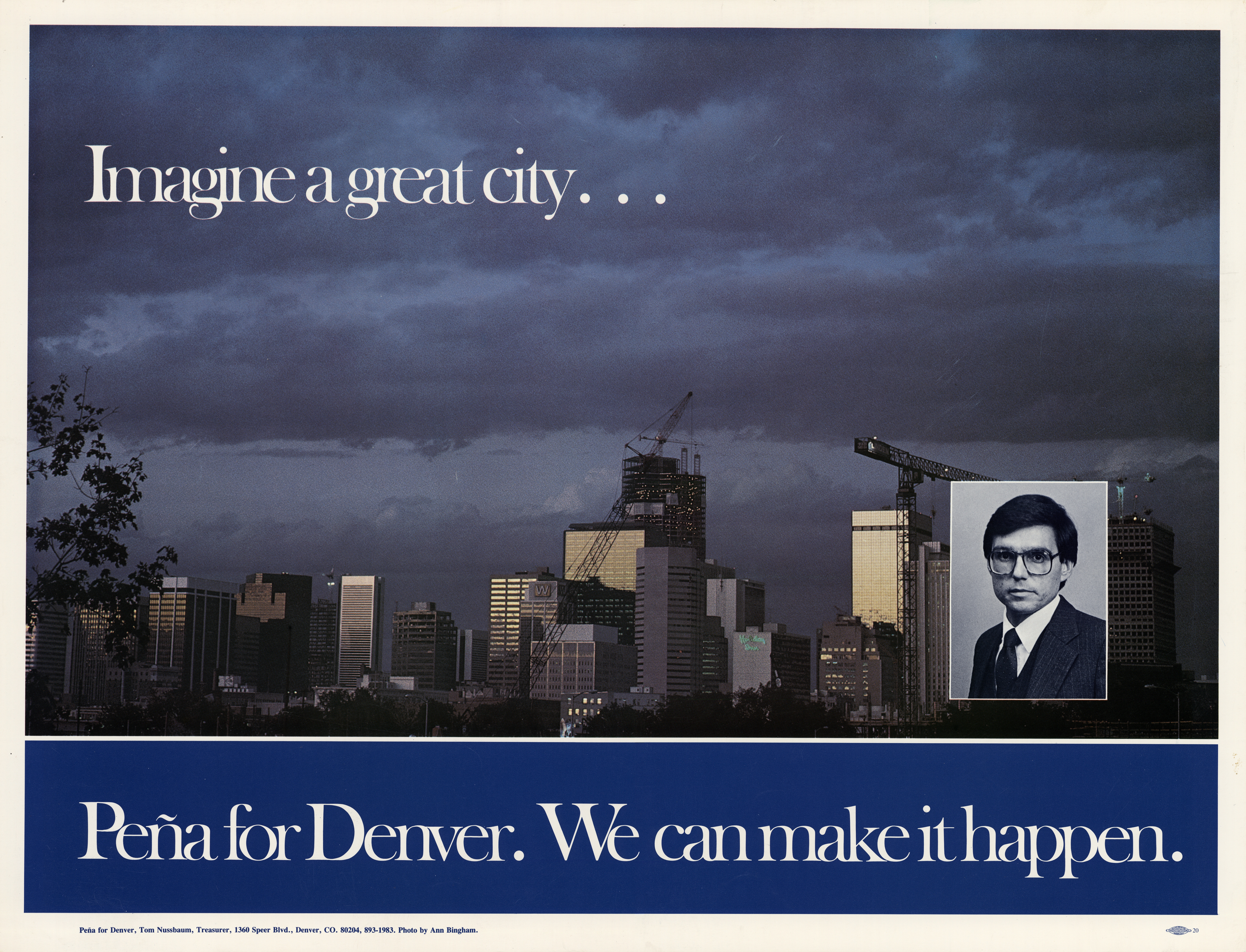
“Imagine a Great City” poster from Peña's mayoral campaign, 1983.
Peña threw the weight of his office behind the grassroots push for historic preservation that Denverites had mobilized in the preceding decade. By 1981, preservationists, like Lisa Purdy with Historic Denver, Inc., had started campaigning to designate Lower Downtown as a mixed-use historic district like Larimer Square, and city business leaders supported their efforts by encouraging a focus on Denver’s future. In 1982, Lower Downtown was rezoned with incentives for property owners to preserve historic structures. Yet the bust of the oil boom prevented owner-driven preservation, as owners prefered demolition to paying for maintenance and taxes on historic properties.
Upon his election as mayor, Peña and his administration concentrated on ways to revitalize downtown, where 31 percent of the buildings were vacant due to the recession and the mass exodus of commerce and the workforce outside the city center. Peña believed that a vibrant downtown was the key to the city’s survival, and in 1984 his administration worked on a fifty-year plan that included the protection and enhancement of the city’s historic neighborhoods. Four years later, the city designated Lower Downtown as a historic district. Tireless advocates like Barbara Sudler worked alongside organizations like Historic Denver to push the administration to make the 1988 designation a reality, saving a total of 180 buildings in twenty-two downtown blocks, despite property-owner opposition. Ultimately, Peña and advocates believed that capitalizing on the city’s historic urban fabric promoted economic development and that preserving the city’s character would enhance public morale. They were right: a 1990 economic review revealed that Lower Downtown had prospered.
Despite Peña’s support for historic preservation, the city’s built environment continued to face significant losses. The community came together in mourning at the demolition of the Central Savings Bank, hosting a public wake for the building. Historic Denver also pushed to save Pei’s hyperbolic paraboloid structure at Zeckendorf Plaza, ultimately razed in 1996.
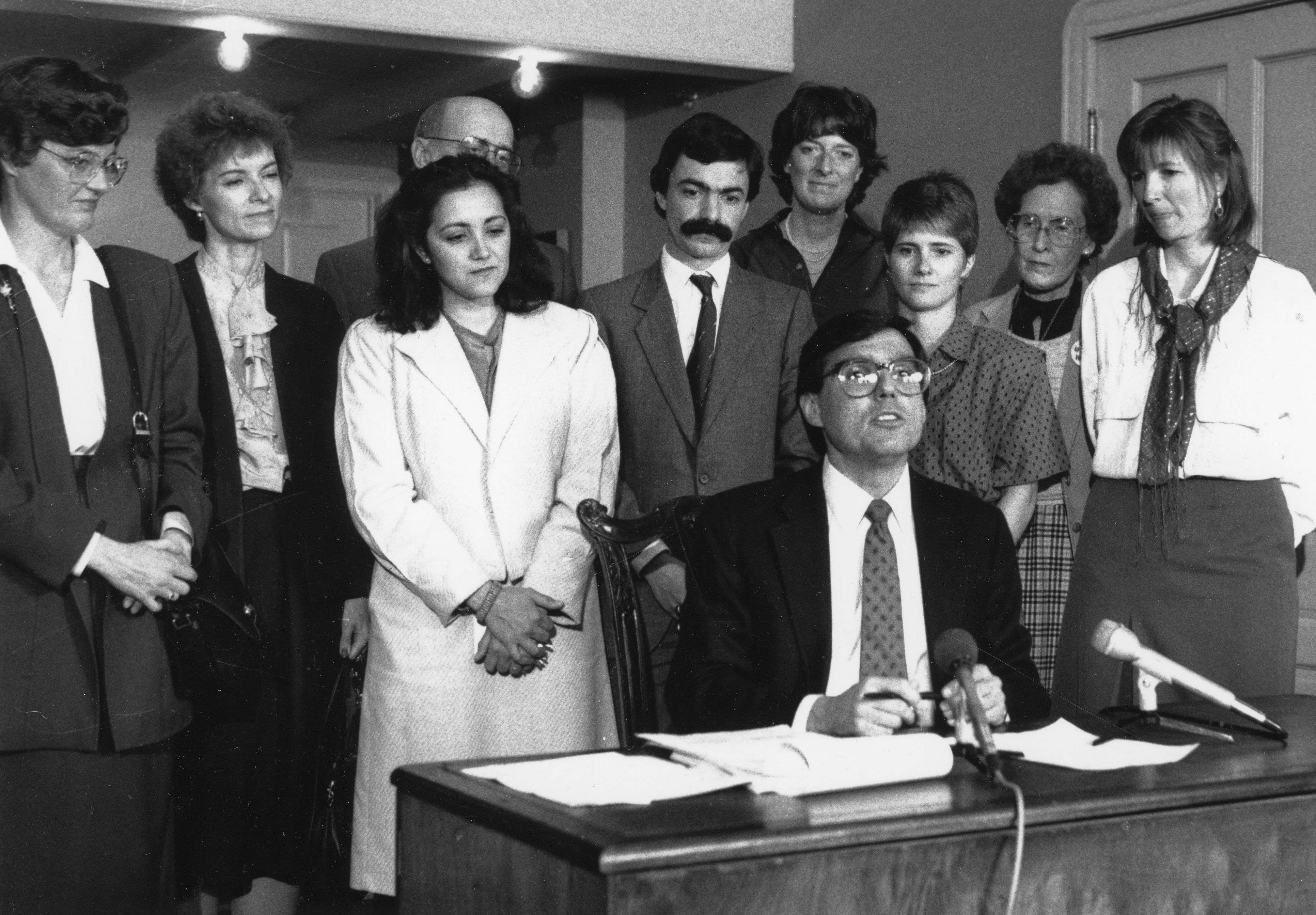
Mayor Federico Peña signs Lower Downtown's landmark designation papers, 1988.
Nevertheless, the LoDo designation had a lasting impact on the direction of Denver’s development, and epitomizing the new infill-oriented approach to city planning of the time was the creation of Coors Field.
The siting of Coors Field in Lower Downtown reflects the impact of the district’s historic designation on subsequent development. Major League Baseball was one of Peña’s visions for Denver, and, instead of placing the ballpark outside the city center, his administration advocated for its placement at the edge of Lower Downtown. The context of the neighborhood in turn shaped Coors Field’s design. After encouragement from the city and local architects, the ballpark’s designers, HOK, clad the stadium in local red brick to evoke Lower Downtown’s industrial past. The ballpark’s clock mimics Denver landmarks like Union Station and the Daniels & Fisher Tower. As the late Jennifer Moulton, former Historic Denver president and Denver planning director, once said, “Coors Field looks as good as it does because of huge public participation. If we don’t demand the quality of development of the public realm we want, we’re going to get the kind of private development we deserve.”
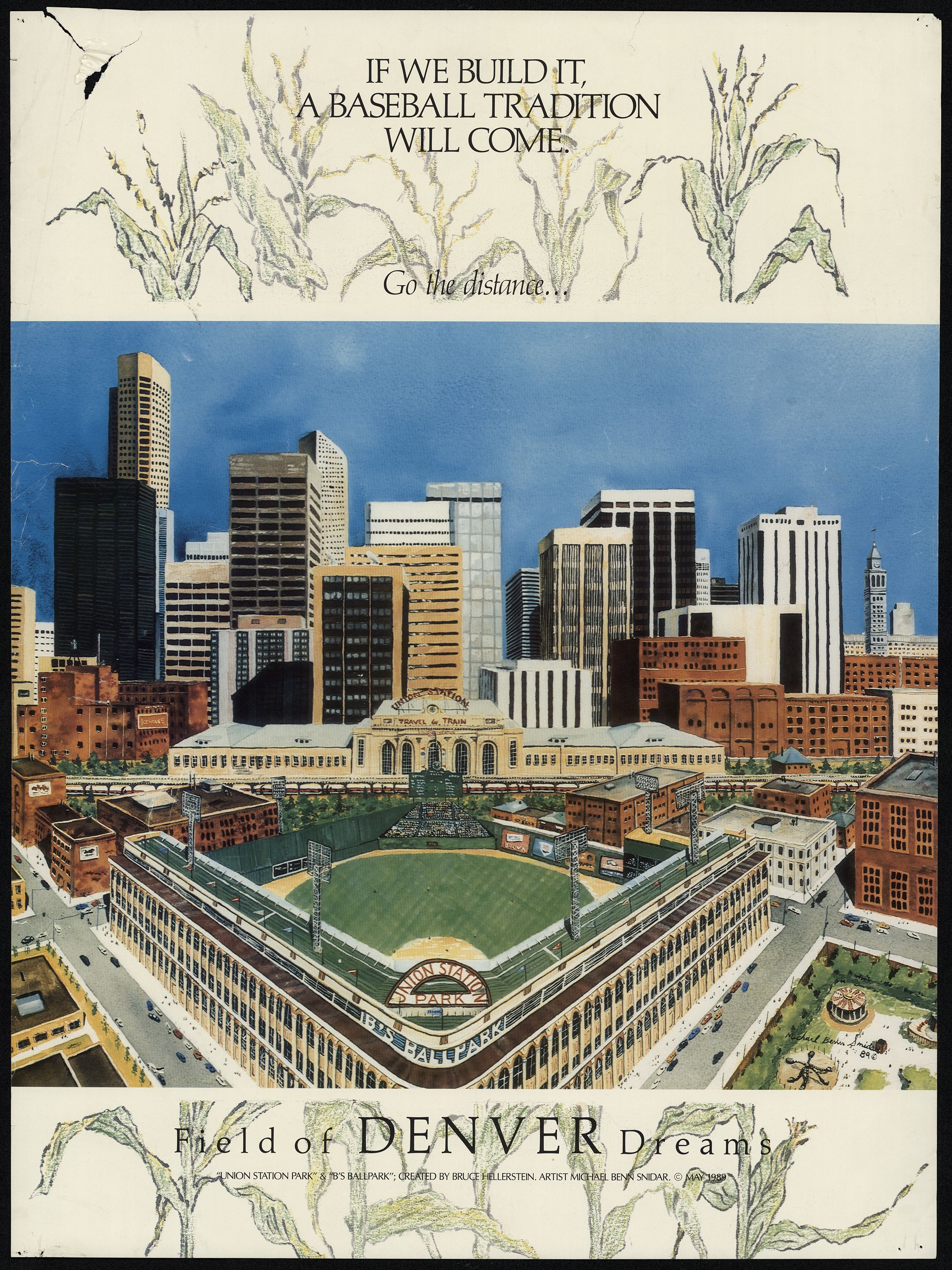
Michael Benn Snidar and Bruce Hellerstein, "Field of Dreams" poster, 1989.
Coors Field fundamentally changed Lower Downtown, raising property values and leading to the gentrification of downtown neighborhoods, but it also started the trajectory of new sports arenas and districts. The Pepsi Center (today’s Ball Arena), was built in 1999 at Speer Boulevard on the north side of the Auraria Campus. Like Coors Field, it became a major part of downtown’s new identity, following the 1995 addition of the relocated Elitch Gardens amusement park. In turn, the 2001 Mile High Stadium, which voters supported by passing a 1998 referendum to replace the original stadium, was built on the other side of the South Platte River at Interstate 25. While these projects were realized under Federico Peña’s successor, Mayor Wellington Webb, they were extensions of Peña’s larger aims for the city and the region.
Indeed, regional thinking was a major part of Peña’s vision, as reflected in the expansion of the Regional Transportation District during these years. When RTD was established in 1969 to take over the Denver Tramway Company’s bus routes, it strove to create a mass-transit plan for the seven counties of the metropolitan region. The Sixteenth Street Mall transitway bolstered RTD’s presence downtown when it opened in 1982. Yet already two years prior, RTD had proposed a light rail system. Service would not start until 1994, when its first line opened: the Central Corridor, which ran from Thirtieth Avenue and Downing Street through Five Points and downtown to I-25 and Broadway. Subsequent lines opened in 2000 and 2006, reaching the southern corridors of the metro area. Promotional campaigns instructed Denver residents on how to safely navigate the urban spaces that the quiet light rail transformed with slogans like “Look, Listen and Live.”
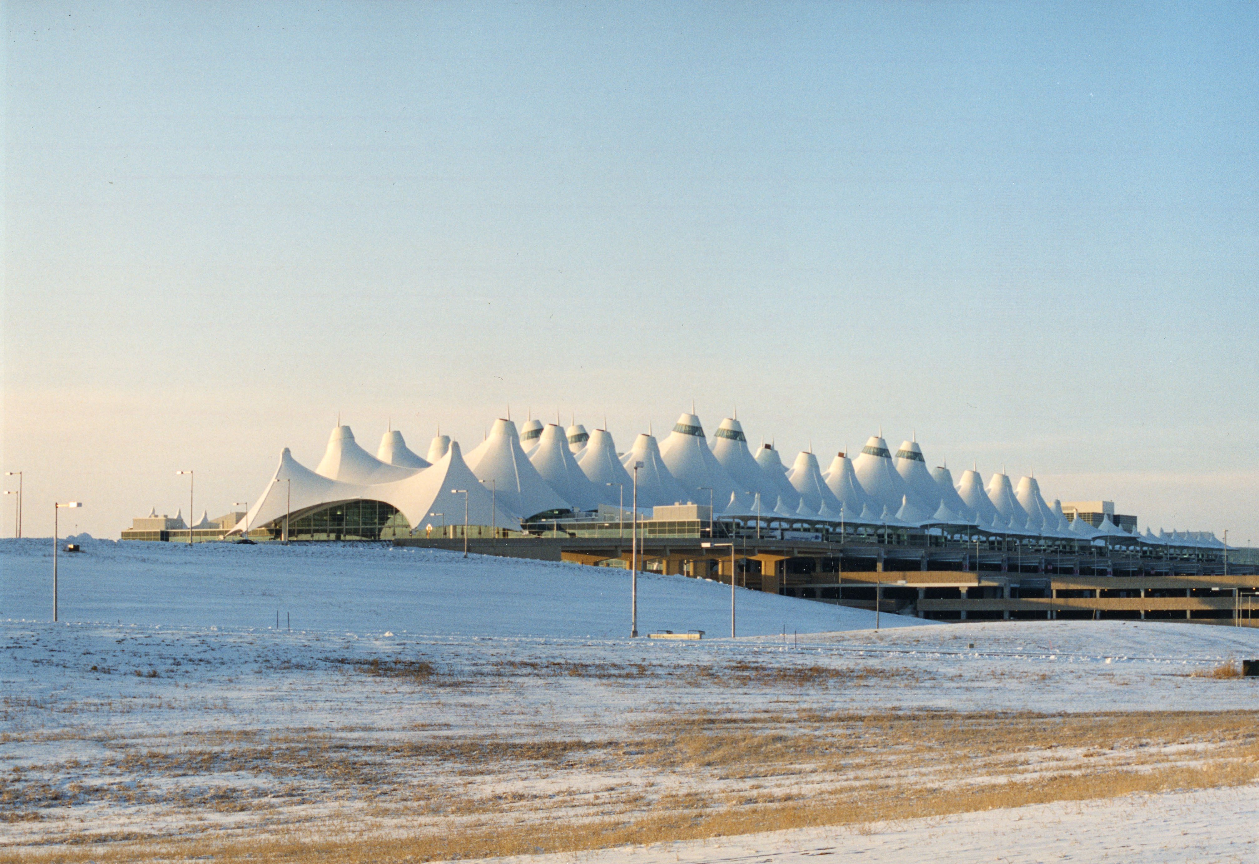
The most significant regional intervention, however, was Denver International Airport, a key component of Peña’s campaign promise to revitalize Denver and the metropolitan area. Peña and supporters contended that a major international airport would enable Denver to become an economically competitive “world-class city.” The creation of DIA required annexing land from Adams County, which Adams County voters approved in 1988. Denver residents in turn approved the proposition in 1989, with major support from business leaders and politicians. DIA opened in 1995, though not without controversy, and the Denver firm Fentress Bradburn Architects (now Fentress Architects) designed its innovative structure. The design exemplifies the firm’s emphasis on using context to create identity, as the airport’s dramatic, multiple-peaked roof references the jagged forms of the Rocky Mountains.
DIA replaced Stapleton International Airport, freeing up 4,700 acres for redevelopment— the largest redevelopment opportunity in Denver’s history. In 1999, the city selected Forest City Enterprises to develop a master-planned community at the former airport’s site. There, planners Calthorpe Associates designed a neighborhood of more than 12,000 homes, 13 million square feet of commercial space, and over 1,000 acres of parks and open space. Adhering to the New Urbanism approach to planning, Calthorpe created a sustainable, human-scaled urban design for the neighborhood by focusing on walkable streets, close proximity between housing and shopping, and accessible public spaces. Harkening back to the area’s previous life as an airport, the control tower remained, punctuating the center of the neighborhood’s Central Park. In 2020, the neighborhood took the name of the park after Denverites protested to remove its “Stapleton” moniker because its namesake, former mayor Benjamin Stapleton, had been a member of the Ku Klux Klan.
Peña’s vision for Denver also reprised Speer-era interventions by expanding the cultural institutions surrounding the Civic Center, many of which were completed under Wellington Webb and his successor, John Hickenlooper. For the expansion of the Denver Central Library, funded by a 1990 bond issue that won voters’ overwhelming support, Denverites rallied to save local architect Burnham Hoyt’s original modernist 1955 library, and the City and County held a design competition to select the architect for the addition. The renowned postmodern architect Michael Graves won the competition and was accompanied by Denver firm Klipp Colussy Jenks DuBois Architects on the project, which opened to the public in 1995. The cultural center grew with the work of another star architect when, in 2000, the Denver Art Museum selected Daniel Libeskind to design the museum’s Frederic C. Hamilton Building, which opened in 2006. Clad in titanium panels, the building’s complex design of sloping planes draws upon the form of the Rocky Mountains. On the north side of the Civic Center across Colfax Avenue, Tryba Architects’ 2002 Wellington E. Webb Building modernized an existing 1949 International Style building to create an attached twelve-story office tower. Holding the city offices that shape Denver’s built environment, including Public Works and Planning and Development, the building connects the Civic Center to the city’s Central Business District.
During this period, Denver also returned to the South Platte River with a system of parks, parkways, and river reclamation that extended Speer-era aims while continuing the tradition of grassroots city-building activism. Efforts to reclaim the South Platte began after the flood of 1965, which devastated the Central Platte Valley and rendered Denver’s riverfront unsafe and inaccessible. In 1974, former state legislator Joe Shoemaker started a bipartisan group of community activists and business leaders to promote the construction of Confluence Park, among other riverfront improvement projects. This group became the Greenway Foundation, which worked to reclaim the land along the South Platte and Cherry Creek through Denver and neighboring counties. Mayor Federico Peña supported the foundation while in office and encouraged the development of the Central Platte Valley more broadly.
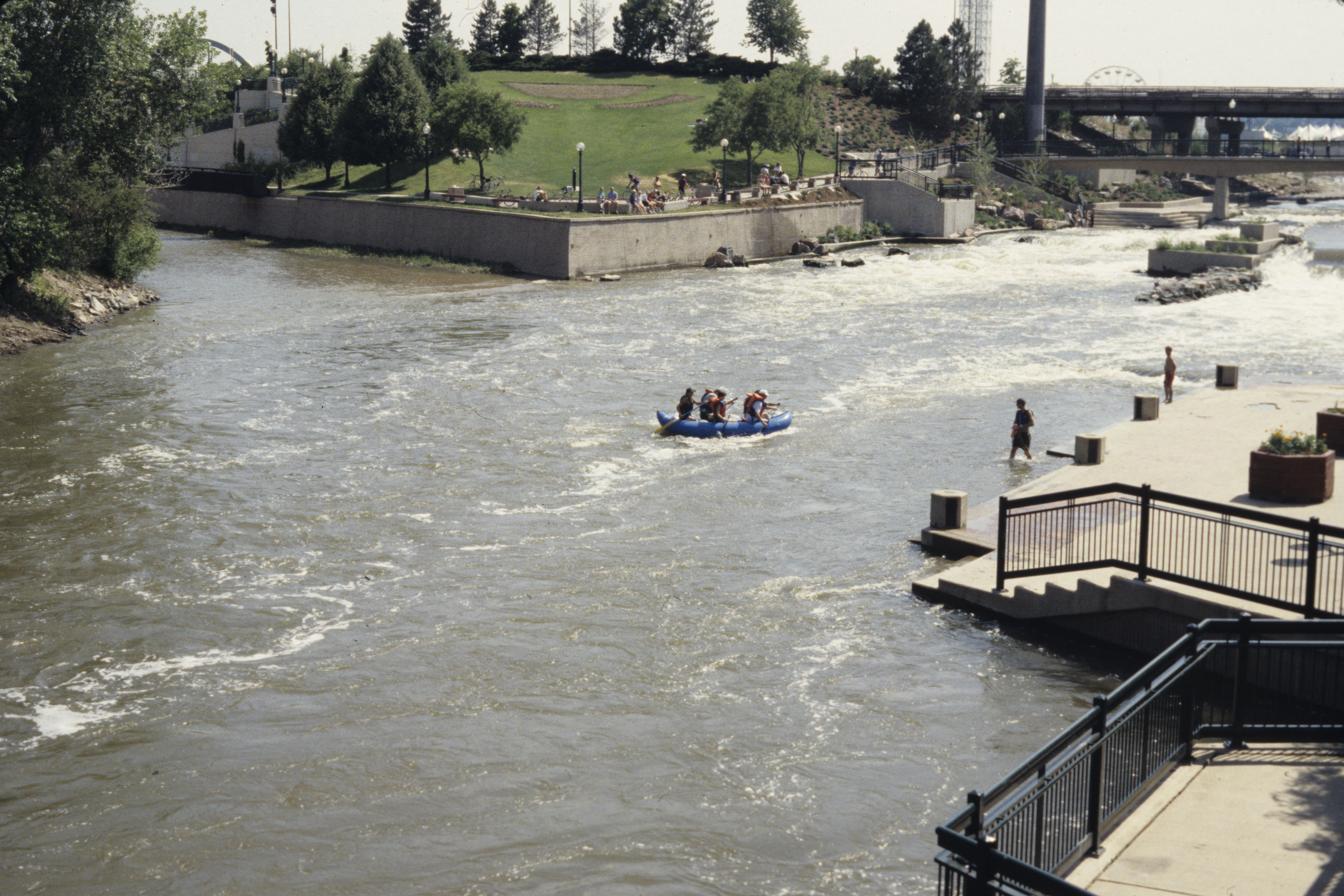
Confluence Park, 1995.
Indeed, when Peña took office, the Central Platte Valley, which stretches from Union Station to the riverfront, was the last major area of undeveloped land within Denver’s city limits. The mayor supported the valley’s development by bringing together a coalition of business leaders, historically underrepresented communities, and labor interests with the goal of creating new public works that would in turn create jobs and bolster the economy. In 1989, Denver voters supported a $242 million bond issue that would, among other things, build an infrastructure for the development of the Platte Valley. Confluence Park had convinced Denverites that the Platte Valley could become something other than an industrial landscape criss-crossed by viaducts.
Parks advanced the redevelopment of the Central Platte Valley, with their capacity to create public spaces for recreation while spurring development. The Peña, Webb, and Hickenlooper administrations saw the valley transformed by a mixed-use neighborhood plan, a renewed riverfront, and parks, with Richard C. Farley, as Denver’s deputy director of urban design, and the local firm Civitas leading the charge. Here, designers envisioned the Central Platte Valley as an extension of Speer’s parks and parkways system, with the idea to connect Civic Center park to the proposed parks of the Central Platte Valley. Civitas’ 1998 vision for the Central Platte Valley further proposed that the city could grow toward and embrace the river with a chain of parks, a vision directed by a public process and the Central Platte Valley Steering Committee. Civitas designed three parks—Commons Park, the City of Cuernavaca Park, and Centennial Gardens—which were completed by 2003. The 2002 creation of the Millenium Bridge in turn connected the valley to downtown —and ultimately the Highlands—while serving as a landmark for the area.
The creation of the Union Station District with the revitalized Denver Union Station further transformed the Central Platte Valley. The redevelopment of the Union Station neighborhood began in the early 2000s with Continuum Partners as the master developer of the area in a massive public/private partnership. The renovation project was part of a long-term vision to return Union Station to its role as the heart of the city, as it was in Denver’s infancy. The newly refurbished station reopened in 2014 as the gateway to a completely transformed Central Platte Valley.
The expansion of Interstate 70, originally constructed in the 1960s, reveals how the extensive urban interventions of the preceding decades continue to impact communities’ everyday life. The Colorado Department of Transportation’s Central 70 Project, first proposed in 2004, will replace and expand I-70 by lowering the viaduct below the Swansea and Elyria neighborhoods, adding traffic lanes, and building a park over a portion of the freeway, all with the goal of decreasing traffic congestion. The plan replaces the viaduct with a sunken freeway three times as wide as the original and, in the process, displaces fifty-six residences and seventeen businesses in the Globeville, Elyria, and Swansea neighborhoods. The community group Ditch the Ditch rose up to advocate rerouting I-70 along Interstates 76 and 270, arguing that doing so would protect the neighborhood’s residents from the project’s environmental risks to air and groundwater sources. While the project is currently proceeding, this community activism forced an environmental health lawsuit, supported by the Sierra Club and which CDOT settled, agreeing to fund a study of the public health and environmental hazards in the surrounding neighborhoods.
These major interventions have all impacted Denver communities and raise the issues of housing, mobility, health, the environment, and the public realm within the decisions that continually define Denver’s future. While Denver has long been considered a resilient city—as the setbacks of fire and flood and the capriciousness of a boom-and-bust economy have shaped the city since its early history—it faces increasing challenges today.
What might a resilient future Denver look like?
More from The Colorado Magazine
Federico Peña, in His Own Words Federico Peña was elected Denver’s first Hispanic mayor in 1983. He went on to serve as U.S. Secretary of Transportation and then as Secretary of Energy during the Clinton Administration.
The Master Weaver of the San Luis Valley Eppie Archuleta’s Legacy
From the KKK to The Proud Boys What A Forty-Year-Old Book on the Colorado Klan Teaches Us About Hate Organizations Today

